Microclimates are tiny pockets within our environment that have unique characteristics that set them apart from the surrounding area. You might be wondering how something so small can make such a big impact, but trust us, these microclimates play a significant role in shaping our climate and ecosystems. From urban heat islands that trap pollution and heat to coastal areas where sea levels are rising at alarming rates, it’s essential we understand how microclimates work.
In this comprehensive guide, we’ll take you on a journey to explore the fascinating world of microclimates. We’ll delve into the techniques used to measure and map these ecosystems, discuss the far-reaching impacts of climate change on microclimates, and examine strategies for adapting to these changes. By the end of our exploration, you’ll have a deeper appreciation for the intricate relationships within our environment and how we can work with nature to mitigate its effects.
What are Microclimates?
So, what exactly is a microclimate and how does it affect your garden or outdoor space? Let’s dive into the world of microclimates and explore this fascinating concept.
Defining Microclimates
A microclimate is essentially a small area within a larger climate that has its own unique set of environmental conditions. This can be due to various factors such as topography, vegetation cover, water bodies, and human activities.
For instance, urban areas like cities and towns often have their own distinct microclimates. A city’s central business district might be warmer than the surrounding suburbs due to the heat island effect caused by tall buildings and pavement. On the other hand, an area with a high concentration of trees can create a cooler microclimate as trees provide shade and absorb carbon dioxide.
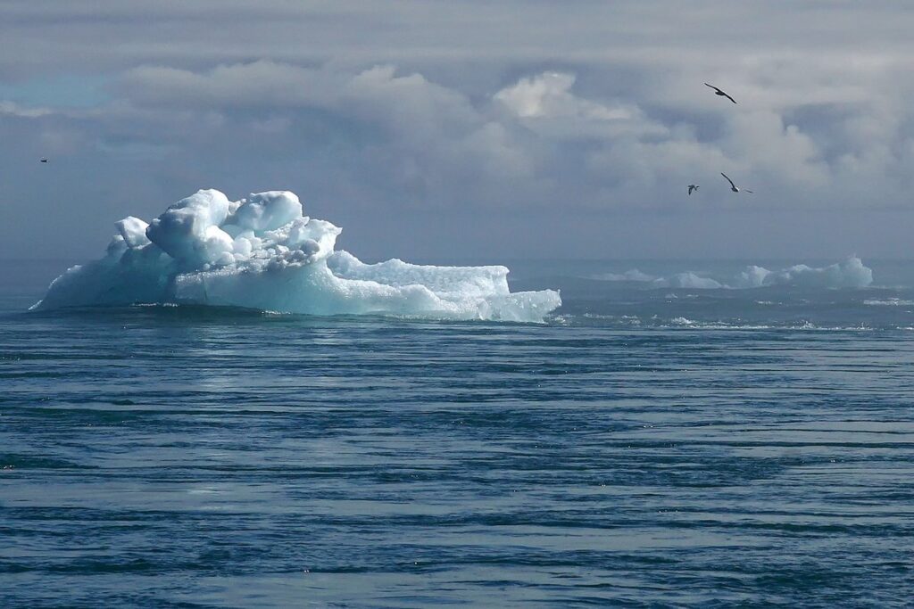
Microclimates can also be found in natural landscapes like mountains, valleys, and coastlines. For example, a valley may have its own microclimate that’s different from the surrounding hills due to the way it traps heat and moisture. Similarly, coastal areas often experience a unique microclimate influenced by ocean currents and sea temperatures.
When identifying microclimates, consider factors like land use, soil type, water availability, and vegetation cover. By understanding these conditions, you can better appreciate how microclimates work and their impact on the environment.
Characteristics of Microclimates
A microclimate is characterized by unique temperature patterns that can differ significantly from the surrounding environment. This can be due to various factors such as proximity to large bodies of water, urban heat islands, or the presence of vegetation. For instance, a valley surrounded by hills may experience colder temperatures than areas at higher elevations.
Humidity levels also play a crucial role in defining microclimates. Areas near large lakes or oceans tend to be more humid due to the moisture-laden air. Conversely, dry regions like deserts have extremely low humidity levels. Wind patterns are another essential characteristic of microclimates. For example, coastal areas often experience strong winds due to the prevailing wind direction.
Vegetation also contributes significantly to the characteristics of a microclimate. Dense forests can create a cooler and more humid environment, while open grasslands tend to be hotter and drier. When evaluating your local climate, pay attention to these characteristics to better understand the unique conditions in your area. This knowledge will enable you to adapt your gardening or outdoor activities accordingly, ensuring optimal results.
Types of Microclimates
There are several distinct types of microclimates, each shaped by unique combinations of geography and climate, affecting everything from temperature to precipitation. Let’s explore these different zones in more detail.
Urban Microclimates
When we think of microclimates, we often imagine them as occurring naturally in the midst of vast wilderness areas. However, urban microclimates are just as significant and fascinating, shaping the environment within our cities in profound ways.
These built-up areas create unique microclimates due to several key factors. For one, pavement density plays a critical role – the more paved surfaces, the greater the heat island effect, resulting from reduced evapotranspiration and increased absorption of solar radiation. This, in turn, can elevate nighttime temperatures by as much as 2-4°C (3.6-7.2°F). Moreover, the materials used in building construction also contribute to microclimatic differences: darker-colored surfaces absorb more heat than lighter ones, while reflective coatings and green roofs help mitigate this effect.
Human activity is another crucial factor influencing urban microclimates. For instance, increased levels of particulate matter and nitrogen dioxide emissions from vehicles can alter the local air chemistry, potentially exacerbating respiratory issues among residents. To mitigate these effects, consider incorporating more green spaces into your community’s design: not only do they help regulate temperatures through evapotranspiration, but also improve air quality by absorbing pollutants.
Cities like Chicago, with its abundance of parks and green spaces, have successfully reduced urban heat islands through the incorporation of green roofs, green walls, and other sustainable designs. By understanding and addressing these factors, you can create a more livable environment for yourself and your community.
Coastal Microclimates
Coastal regions are known for their unique and dynamic microclimates. The constant interaction between land and sea creates a fascinating mix of conditions that can be both challenging and beneficial for plant growth, human settlement, and outdoor activities.
One of the primary factors shaping coastal microclimates is ocean winds. These winds carry moisture from the ocean, resulting in higher humidity levels near the coast compared to inland areas. This excess moisture often leads to overcast skies and mild temperatures during the day. However, at night, the temperature drops significantly as the land rapidly cools due to its lower heat capacity.
Precipitation patterns also play a significant role in coastal microclimates. The ocean’s influence can create areas with high rainfall, while nearby inland regions may experience drought conditions. This variability is evident in the distinct climate zones along coastlines worldwide. For instance, the Mediterranean region exhibits a dry and warm climate during summer, only to transform into a wet and cool one during winter.
If you’re interested in exploring coastal microclimates further, consider monitoring temperature fluctuations and precipitation patterns near your local coastline. You can also observe how nearby vegetation responds to these conditions, often resulting in diverse plant species thriving in specific niches. By understanding the unique characteristics of coastal microclimates, you’ll gain a deeper appreciation for the complex interplay between land and sea.
Creating Microclimates
To create microclimates, you’ll want to consider how to manipulate the environment around your plants to replicate their natural conditions. This means getting creative with shelter and protection.
Artificial Microclimates
Artificial microclimates are intentionally created spaces that mimic the conditions of a natural ecosystem. By leveraging architecture and landscape design, individuals can manipulate temperature, humidity, air quality, and light levels to create a unique environment. For instance, some buildings incorporate green roofs or living walls to regulate internal temperatures, reduce energy consumption, and provide insulation.
In urban planning, microclimates are also created through the strategic placement of parks and gardens. These oases can act as natural buffers against pollution, noise, and heat, making them havens for both residents and wildlife. Additionally, landscape designers use techniques like rainwater harvesting and grey water systems to conserve resources and reduce environmental impact.
When designing artificial microclimates, consider factors such as sunlight exposure, wind direction, and soil quality. Incorporate plants that thrive in the specific conditions of your space, and prioritize using locally sourced materials to minimize carbon footprint. By thoughtfully crafting these environments, you can not only enhance indoor spaces but also support biodiversity and contribute to a more sustainable future.
Some notable examples include the “vertical farms” in Japan, which use climate-controlled greenhouses to cultivate fresh produce year-round, or the “biophilic buildings” in Scandinavian countries that integrate natural light and ventilation systems.
Natural Microclimate Regulation
As we explore the concept of microclimates, it’s essential to understand that natural processes play a significant role in their formation. One such process is evapotranspiration, where plants release water vapor into the air through transpiration and soil moisture evaporates from the surface. This exchange of water between the plant and atmosphere affects temperature, humidity, and even local precipitation patterns.
Consider a forest as an example: dense foliage traps heat, reducing cooling by 10-20°F (5-10°C) compared to open areas. Trees also influence soil moisture levels, which in turn regulate evapotranspiration rates. The unique interplay between plants, soil, and atmosphere creates a distinct microclimate within the forest.
Another natural process contributing to microclimates is topography. Hills, valleys, and mountains disrupt wind patterns, trapping cold air at night or creating “rain shadows” on leeward slopes. These variations in terrain can result in significant temperature differences of up to 20°F (10°C) between adjacent areas.
By recognizing the influence of natural processes like evapotranspiration, soil moisture, and topography, you can harness their potential to create more resilient microclimates.
Measuring and Mapping Microclimates
Now that you have a solid understanding of what microclimates are, let’s dive into measuring and mapping these unique pockets of weather. We’ll explore the tools and techniques used to pinpoint their boundaries.
Tools for Assessing Microclimates
When it comes to assessing microclimates, having the right tools is essential for accurate measurement and analysis. There are various techniques and technologies available, ranging from simple temperature sensors to more advanced remote sensing tools.
Temperature sensors are a great starting point, as they can provide real-time data on air temperature, which is often the most critical factor in determining microclimate conditions. For example, placing a thermometer in a shaded area can help you understand the diurnal temperature range and how it affects plant growth. Other types of sensors, such as humidity and wind speed sensors, can also be used to gain a more comprehensive understanding of your microclimate.
Remote sensing tools, on the other hand, use satellite or aerial imagery to capture data on larger areas. This is particularly useful for monitoring changes in land cover, soil moisture, or temperature patterns over time. For instance, using satellite imagery to analyze crop health and detect stress can help you identify potential issues before they become major problems.
When selecting tools for assessing microclimates, consider the specific needs of your project. For example, if you’re monitoring a small garden, a basic temperature sensor may be sufficient. However, if you’re working on a larger scale or need more detailed data, remote sensing technology might be more suitable.
Applications in Urban Planning and Design
As cities continue to grow and evolve, understanding and mapping microclimates has become increasingly important for urban planning decisions. By doing so, cities can create more livable environments that prioritize public health, sustainability, and resilience.
One key application of microclimate mapping is optimizing building placement and design. For instance, a city might identify areas where buildings tend to trap heat or create “heat islands.” In response, planners could require buildings in these areas to incorporate green roofs or solar panels to mitigate the effects. This not only reduces urban heat island effect but also provides energy savings for residents.
Urban planners can also use microclimate mapping to inform transportation planning and infrastructure development. For example, a city might identify areas with high levels of air pollution and implement bike-share programs or electric vehicle charging stations to encourage cleaner transportation options.
By leveraging microclimate data, cities can create more sustainable, equitable environments that promote the health and well-being of their residents. As you begin your own urban planning projects, consider how mapping microclimates can inform your decisions – prioritize public health, incorporate green infrastructure, and engage with local communities to co-create livable spaces.
The Impact of Climate Change on Microclimates
Climate change is having a profound impact on our planet’s delicate microclimates, altering local weather patterns and ecosystems in unexpected ways. Let’s explore how this shift affects our environment.
Rising Temperatures and Their Effects
As global temperatures continue to rise, microclimates around the world are experiencing significant alterations. The consequences of these changes can be seen in increased heat stress, droughts, and extreme weather events that disrupt ecosystems and impact local communities.
Rising temperatures lead to more frequent and intense heatwaves, which can have devastating effects on plants and animals adapted to milder conditions. For example, the 2019 heatwave in Europe caused widespread crop damage and led to an estimated €1 billion in losses for agriculture. Similarly, droughts are becoming increasingly common, as warmer air holds less moisture, leading to prolonged dry spells that can devastate vegetation.
To mitigate these effects, it’s essential to develop strategies for adapting to changing microclimate conditions. This can include implementing heat-tolerant crop varieties, conserving water resources through efficient irrigation systems, and promoting sustainable land-use practices. By taking proactive steps to address the impacts of climate change on microclimates, we can help protect local ecosystems and support vulnerable communities.
Adaptive Strategies for Mitigating Climate-Driven Changes
As we explore the impact of climate change on microclimates, it’s essential to consider strategies for mitigating its effects. One approach is through urban forestry initiatives, which can help mitigate the urban heat island effect and provide shade for residents. Cities like Chicago and Los Angeles have implemented tree planting programs that not only reduce temperatures but also improve air quality.
Green infrastructure projects are another effective way to adapt to climate-driven changes in microclimates. Rain gardens, green roofs, and permeable pavements can absorb stormwater runoff, reducing the burden on urban drainage systems and decreasing flood risks. For example, the city of Boston has incorporated rain gardens into its public spaces, not only beautifying the area but also managing stormwater effectively.
In addition to these initiatives, incorporating natural or nature-based solutions can help microclimates adapt to climate change. Wetlands restoration, for instance, can improve water quality and reduce the risk of flooding. By incorporating adaptive strategies like urban forestry and green infrastructure projects into our planning, we can better prepare microclimates for the challenges posed by a changing climate.
Frequently Asked Questions
Can microclimates be found anywhere, or are they limited to certain regions?
Yes, microclimates can exist anywhere on the planet, from small gardens to vast urban areas. They’re not exclusive to specific locations or climates; rather, they’re shaped by local factors such as topography, vegetation cover, and human activities. Understanding these factors is crucial for creating and working with microclimates.
How do I measure and map a microclimate in my area?
Measuring and mapping a microclimate can be done using various tools and techniques, including temperature sensors, precipitation gauges, and satellite imagery. You can also use mobile apps that help you monitor local climate conditions. It’s essential to have a clear understanding of the microclimate’s characteristics before developing strategies for working with it.
Are all microclimates created equal? Can some be more resilient than others?
Not all microclimates are equally resilient or adaptable to changing environmental conditions. Some microclimates may be more stable due to their natural topography or vegetation cover, while others might be more vulnerable to extreme weather events or human activities. Understanding the specific characteristics of your local microclimate can help you develop targeted strategies for mitigating climate-driven changes.
Can artificial microclimates be created in areas with harsh climates?
Yes, artificial microclimates can be designed and constructed in areas with challenging environmental conditions. These can include green roofs, urban parks, or even indoor gardens. By leveraging advanced technologies such as hydroponics or aeroponics, you can create stable microclimates that thrive despite external climate fluctuations.
How can I incorporate natural microclimate regulation into my urban planning and design projects?
Incorporating natural microclimate regulation into your urban planning and design projects involves integrating elements like vegetation cover, water bodies, and topography. This can include designing green spaces with native plant species, incorporating rainwater harvesting systems, or using site-specific building designs that take advantage of local climate conditions. By working with nature, you can create more resilient and sustainable microclimates in urban areas.